Helyszín címkék:
Spring hiking tip on the edge of the Buda countryside
Partner content
Article in Turista Magazine
Our article reveals:
• where to find the most beautiful spring flowers and protected plants,
• which historical sights and secret places are worth visiting,
• how you can conquer Nagy-Kopasz,
• what kind of panorama awaits us from the lookout tower.
Departure and first experiences
We have recently recommended several hikes in Buda, which showcased the western edges of the mountain range, full of adventures, but we still have a tip about the area that could be a great early spring program for those who want to take a trip around the capital, but away from the hustle and bustle of the city.
The 15 km route stretches between Biatorbágy and Nagykovácsi, following the green triangle trail that promises panoramic views almost all the way, with numerous points of interest. What’s more, in springtime, the grassy areas of the landscape are covered with beautiful flowers.
Although this is a through hike, thanks to good public transport options, we can plan comfortably and even break up the hike by taking a bus halfway, and the icing on the cake is that there are places to eat and drink along the way.
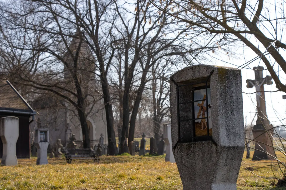
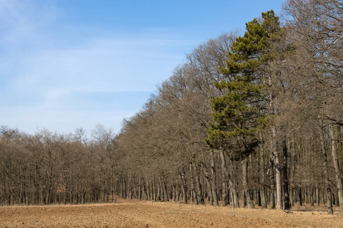
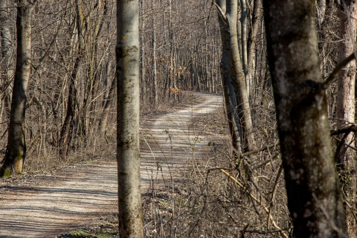
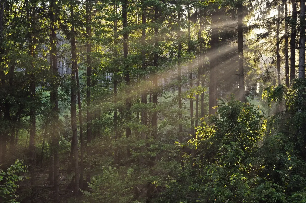
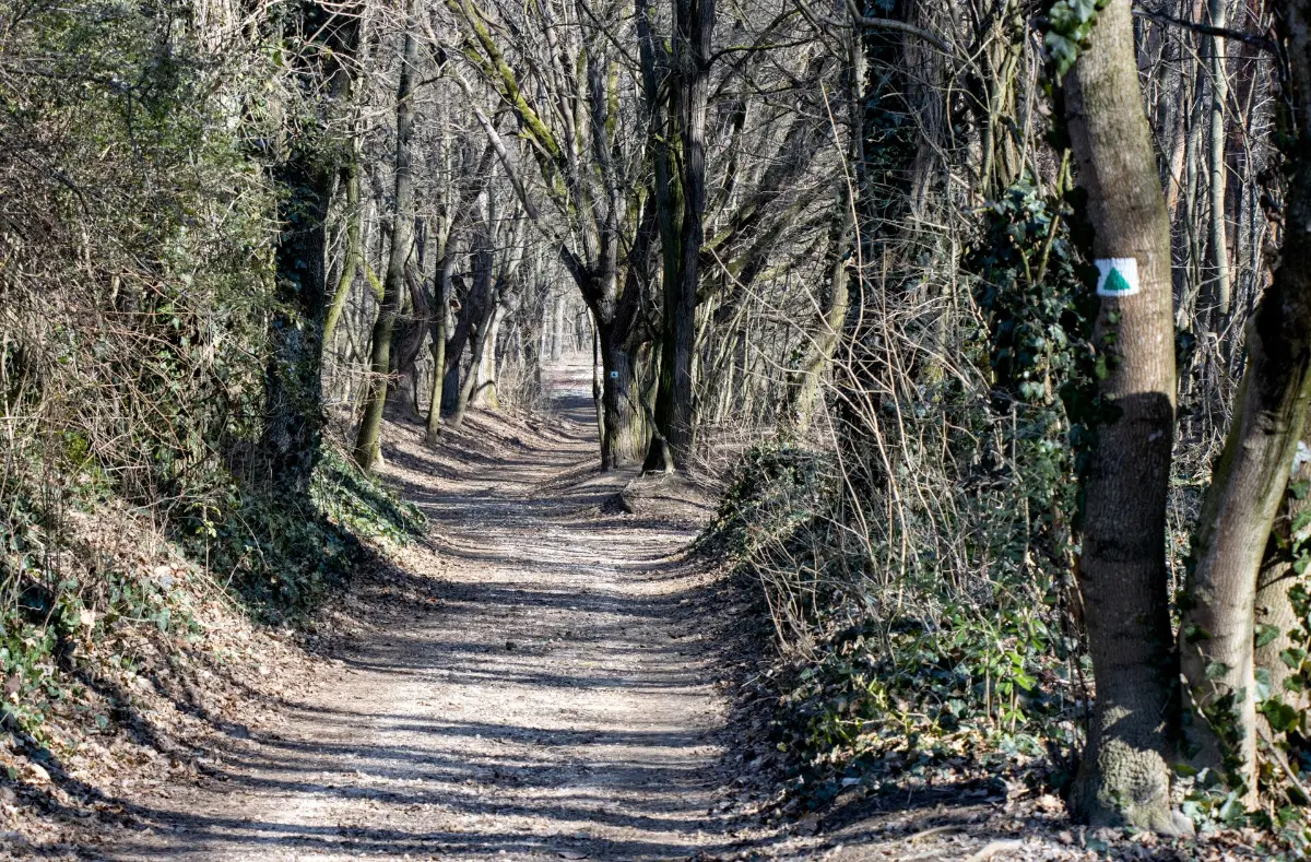
Starting from the green triangle sign north of the Biatorbágy railway station, we only have to walk a few hundred meters to find ourselves in nature. We pass the Chapel of Our Lady of the Sickle with its Calvary, go under the M1 motorway, and arrive at the young part of the Torbágy Forest along the old vineyards, which are now more of a residential area.
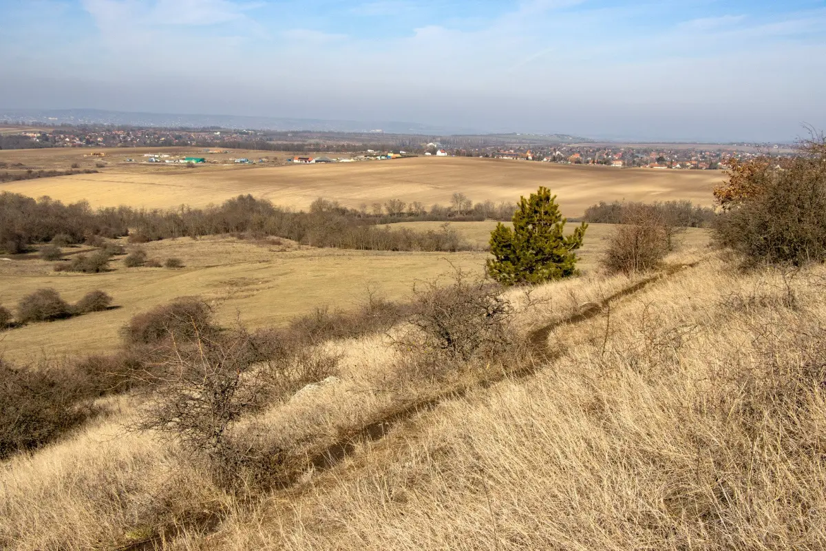
Our wide path leads us gently uphill to the edge of the forest, where we can see the fields of Páty, the foothills of the Zsámbék Basin, and the distant lines of the Gerecse and Vértes Mountains.
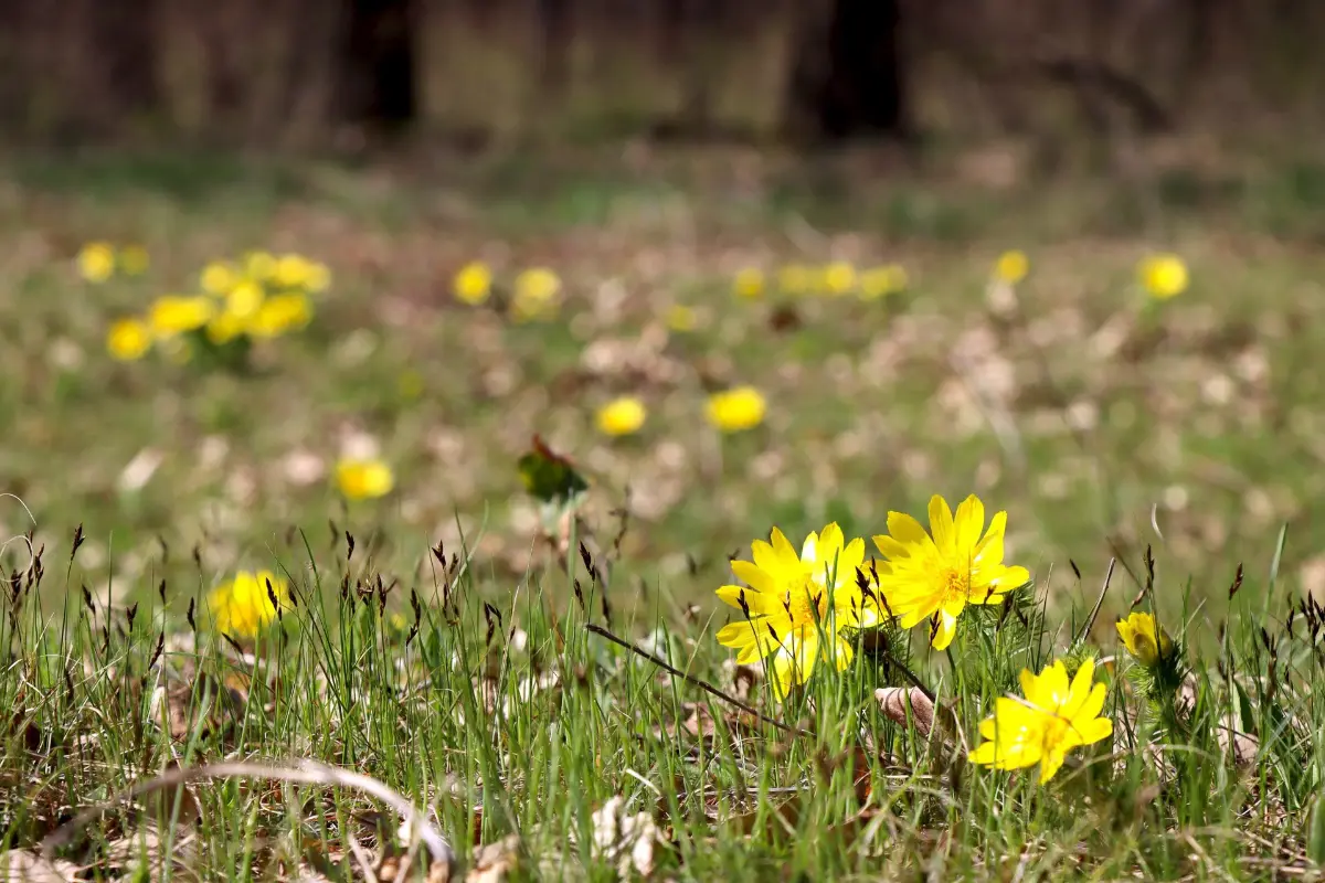
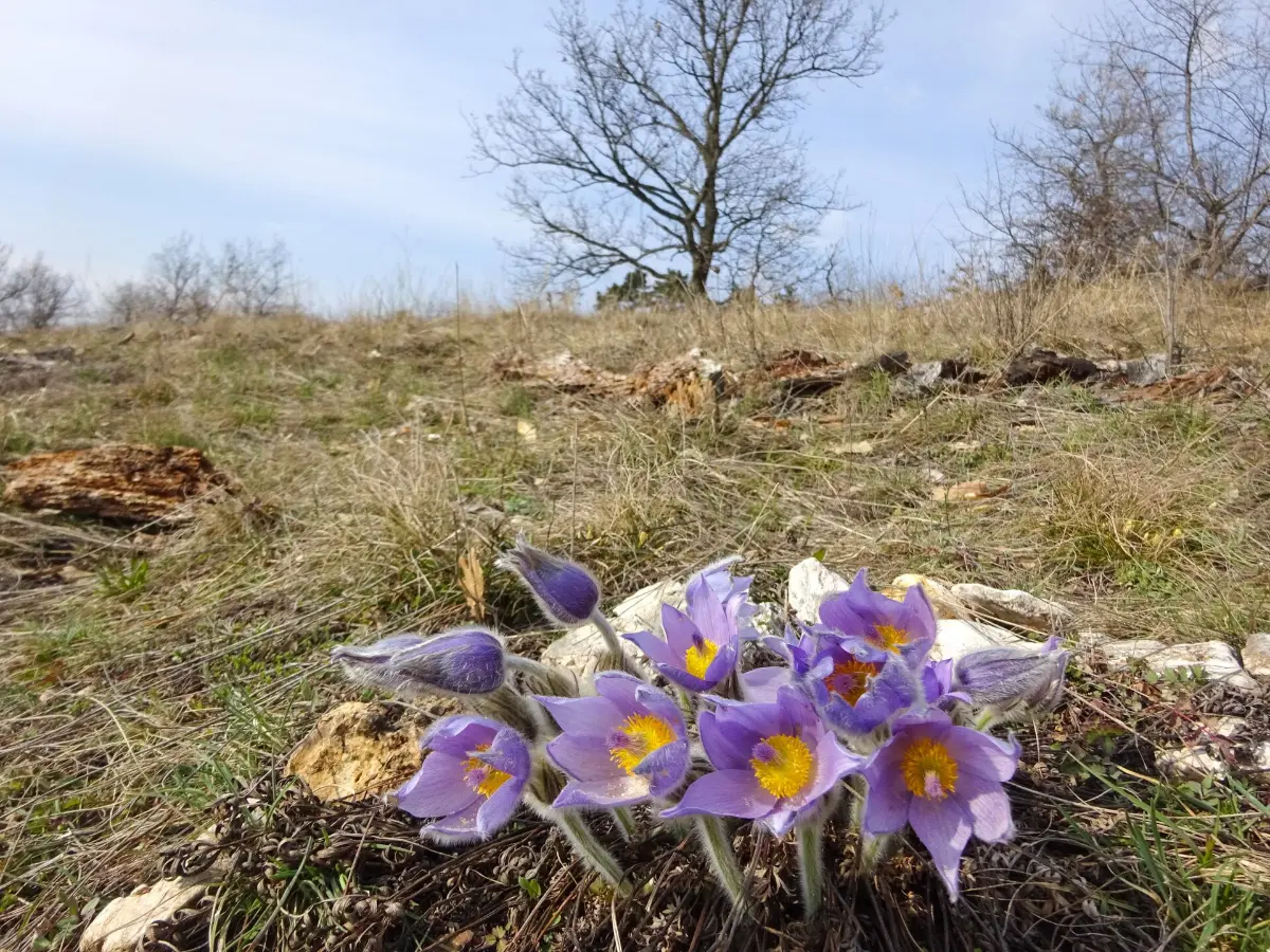
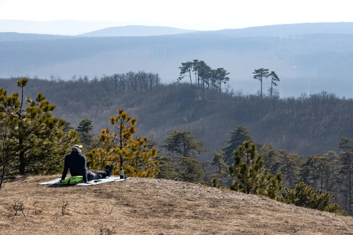
The path, which has been tamed into a trail on the hillside, is lined with scrub and steppe grassland. In March, these open, dry grasslands are dotted with Yellow Adonis and purple Greater Pasque flowers. We will be able to admire these protected plants on the rest of our journey, as well.
Sights and historical curiosities
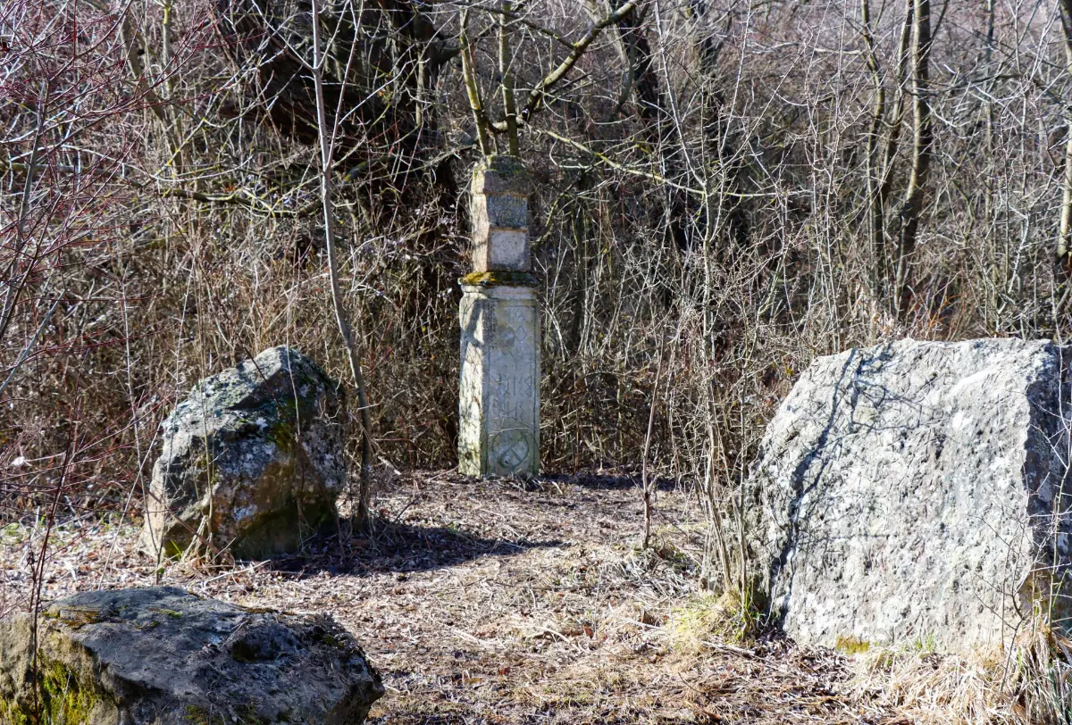
Winding through the quiet landscape of the forest, we approach the sights hidden in the pine forest of Főkút Park Forest. Before climbing the small hill that offers a panoramic view, we visit the historic Főkút spring, which, as evidenced by the ancient inscribed stones found here, was already used by the Romans: they built a bath next to the healing spring and traces of a settlement have also been uncovered. The spring still flows today, but, unfortunately, its water is not currently of drinking quality.
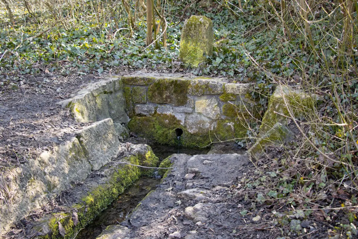
A few steps from the spring, we find stones with Roman inscriptions, and then our path opens up again to a panorama to the west, with pastel-coloured fields stretching out in the foreground and gently rolling hills on the horizon.
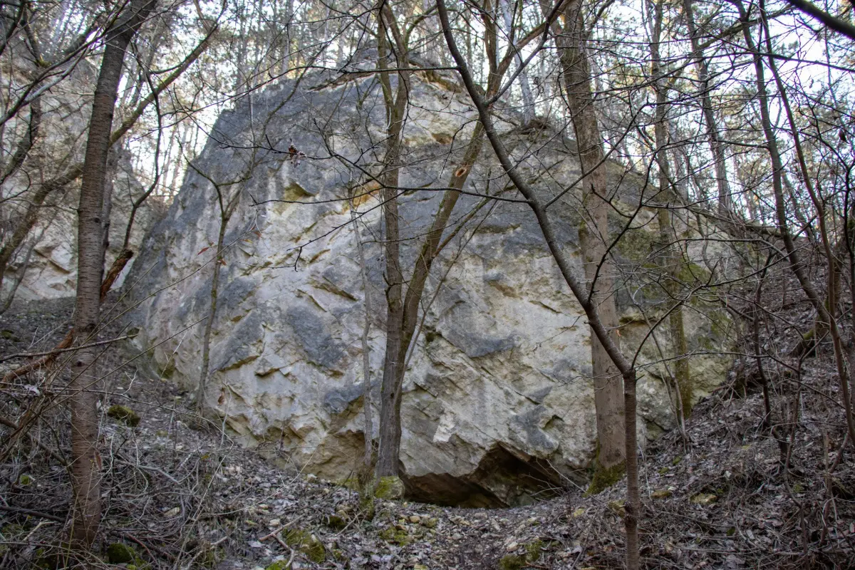
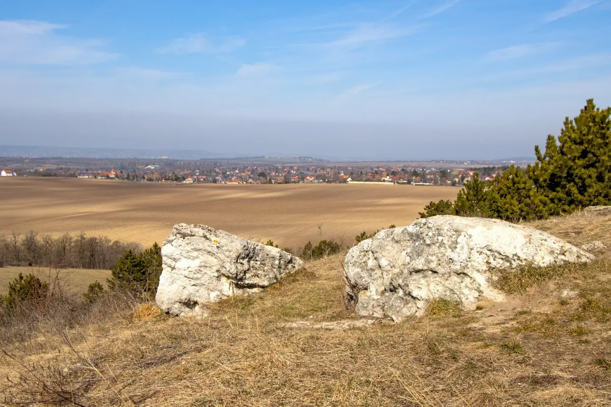
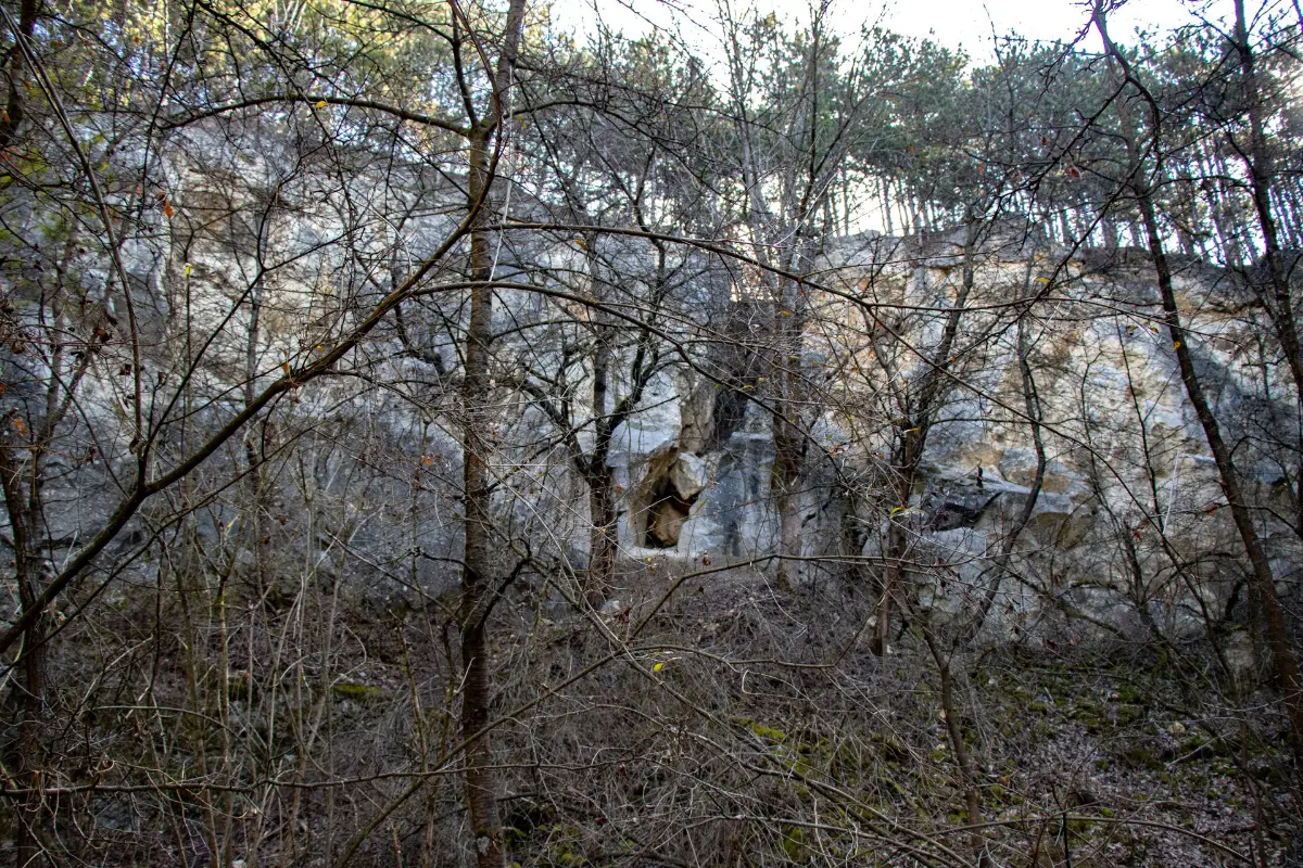
Among other things, we can see Páty, which will be touched by the green road, but before we continue north and descend from the hilltop, it is worth taking a few steps to the spectacular rock wall of the abandoned Főkúti mine, which also includes a cave.
A steep path with wooden railings leads down to the romantic courtyard of the former quarry, which has been reclaimed by nature. Between 1920 and 1960, limestone from the Sarmatian period was quarried here, which was used to produce slaked lime and gravel. During the forty years of mining, approximately 51,000 tons of rock were extracted.
After climbing back up the hill, we arrive at the edge of Páty, where we can decide whether to take a detour of a few hundred meters at the green square sign to the Cukorborsó restaurant, or stay on the triangle sign, which continues along the edge of the Buda countryside, passing the long-distance bus stop.
Crossing the road connecting Páty and Budakeszi, we arrive at the Mézeshegy district of Páty. The family housing area passes quickly, which we leave behind us by climbing over a wild fence with a ladder. Our wide dirt road leads us up a gentle slope to a grove of oak trees.
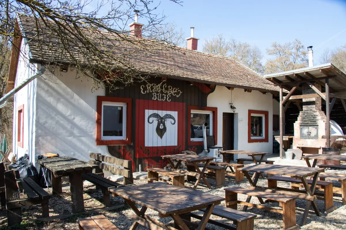
There are no particular sights to see here, but we can continue our hike comfortably in the peaceful silence, and then, crossing the Hideg Valley ditch, we reach the road between Telki and Budakeszi. Halfway along our route, there is a bus stop where we can get off, and the Hidegvölgyi Forest rest area buffet offers food and drinks for refreshment.
Nagy-Kopasz and the end of the tour
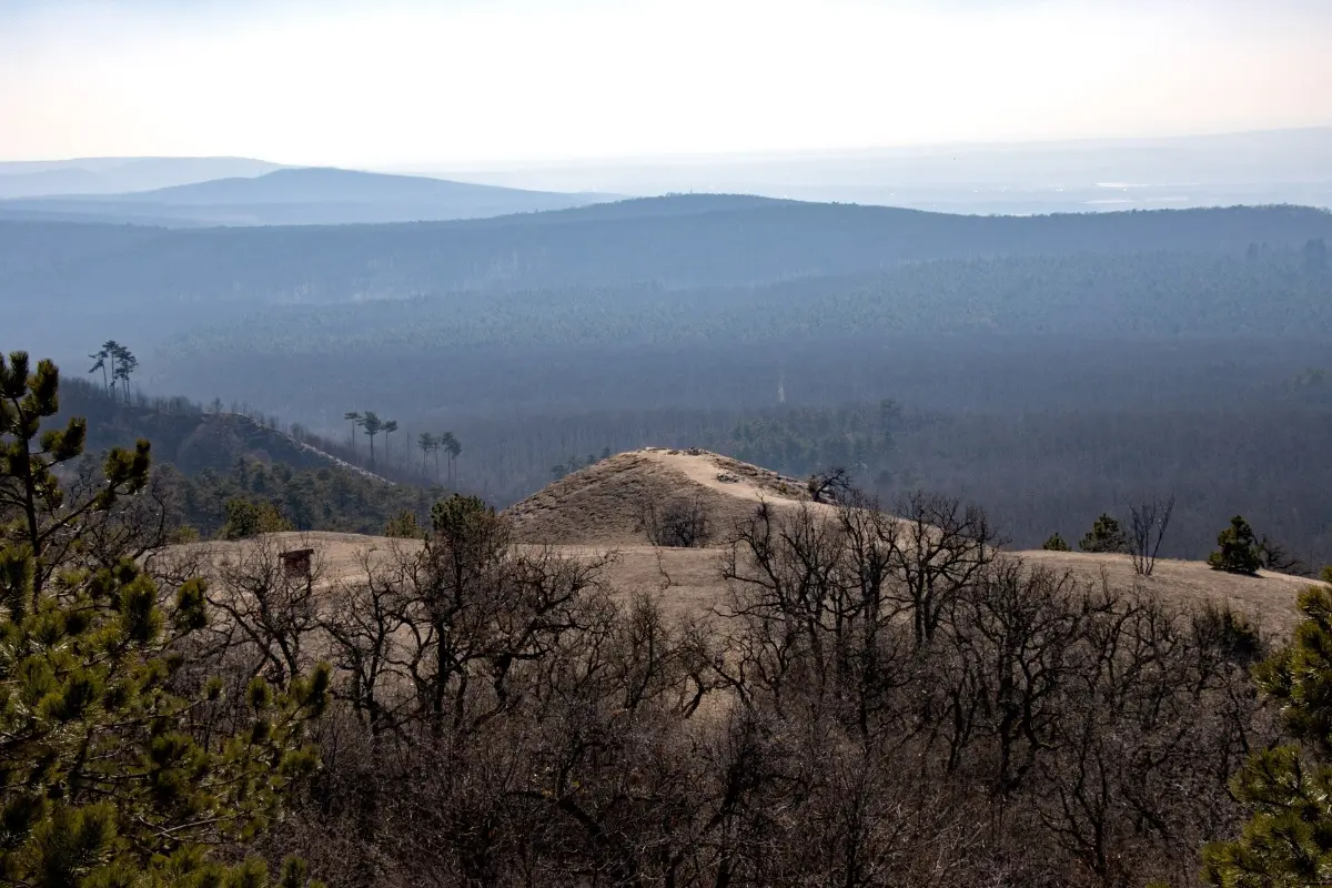
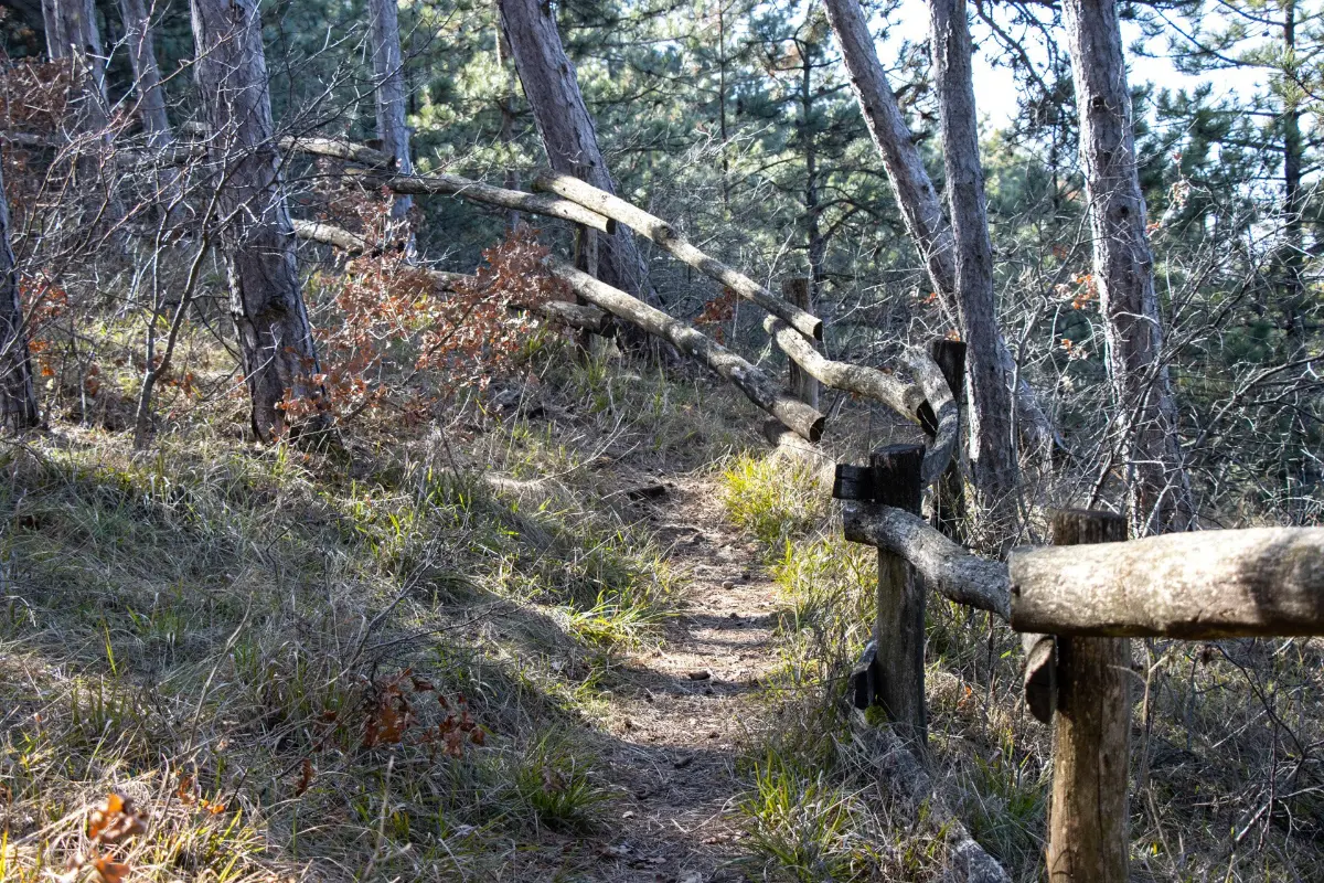
From the rest area, we begin our assault on the highest point of the Buda Hills along the Sisakvirág nature trail. This is the most challenging section of our entire hike in terms of elevation gain, but don't let that scare you off: conquering the 559-meter-high Nagy-Kopasz is not a steep climb, but rather a longer ascent, where we will pass one of the most beautiful parts of our journey, the flower-covered Tarna rest area (Tarnai-pihenő) with its rocky lookout point.
The Tarna rest area’s meadow is home to numerous protected plant species: the white-flowered King Stephen's carnation, the spotted orchid belonging to the orchid family, and the pink and fragrant Garland flower shrub, but these do not yet dot the sunny hillside in early spring.
By the end of winter, the monotonous dolomite rock grasslands are brightened up by Yellow Adonis and Greater Pasque flowers. These magnificent messengers of spring often bloom alone, but in other places they grow in clusters on the grass. It is important to protect these rare and highly protected plants: watch where you step, and of course, never pick or dig them up.
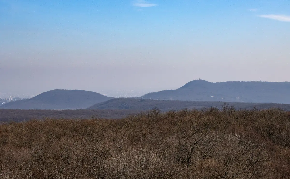
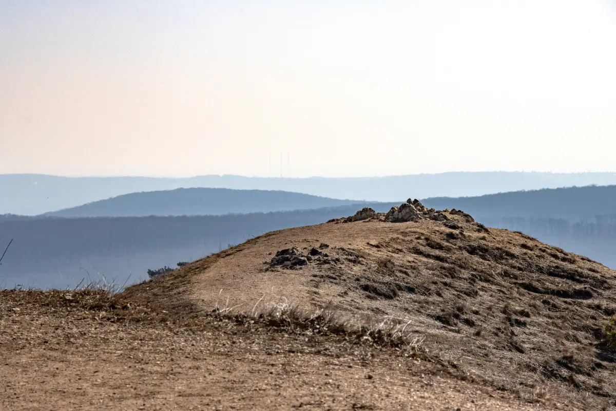
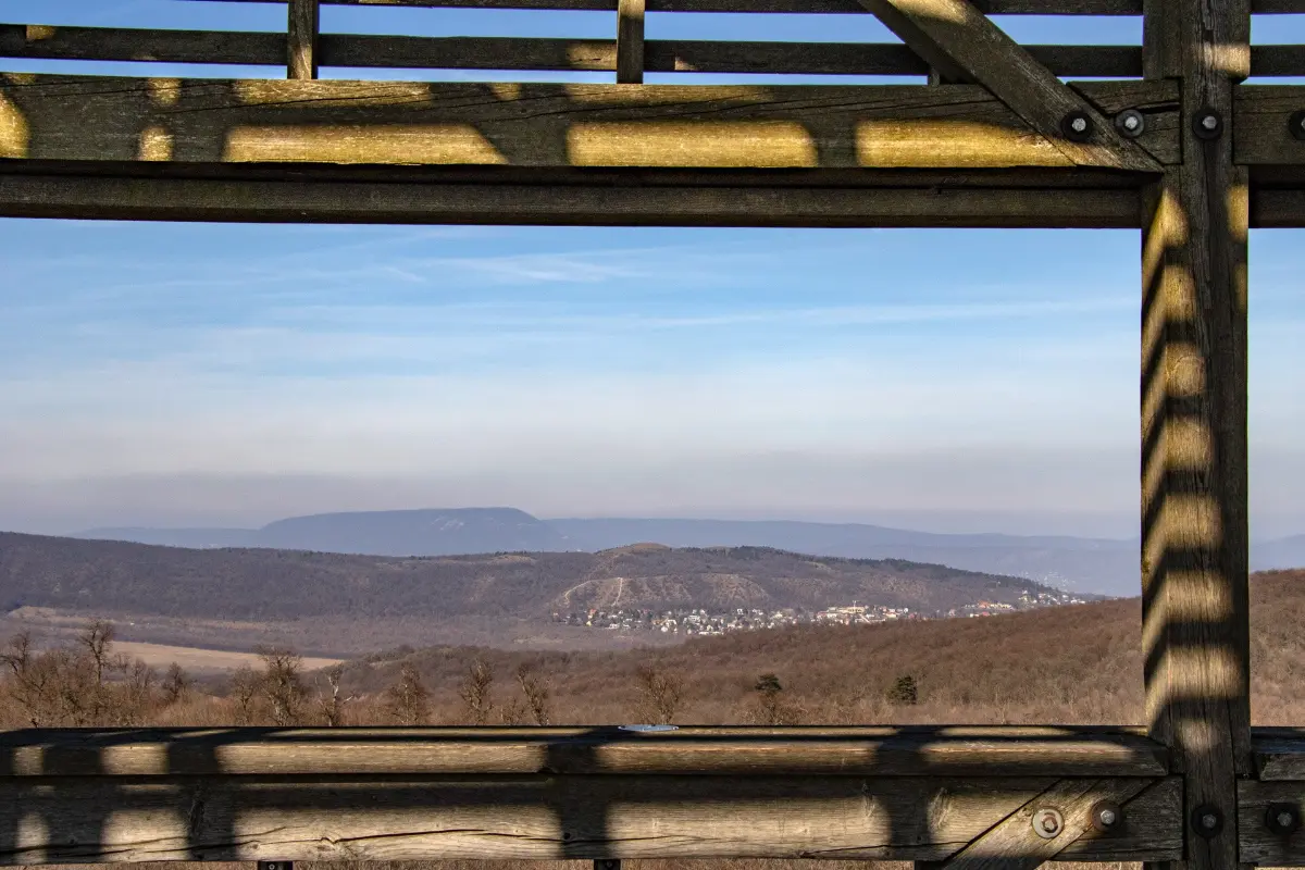
From the barren hilltop of Tarna rest area, covered with black pine trees, we can see the wooded ridge of Kopasz Hill, behind which the western foothills of the Buda Hills, the Tót György Hill and Vár Hill, are visible. On the left side of the view are the Széchenyi Hill’s massif and the barren hills of Budaörs.
Looking to the right, the Zsámbék Basin and the Gerecse offer a distant view. In the hazy distance, the chimneys of the Százhalombatta refinery can sometimes be seen.
We are walking on the dolomite rocks of the Black Mountains, covered with a thin layer of soil. In the last century, undemanding black pine trees were planted here for economic and soil stabilization purposes, but today, due to the climate change, the evergreen trees have begun to die off. Now, the forestry chainsaws are also accelerating the process so that the landscape can regain its barren state covered with natural grass as soon as possible.
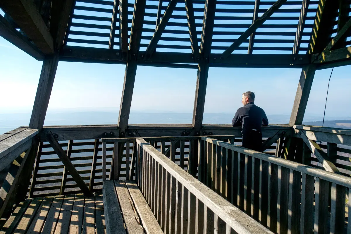
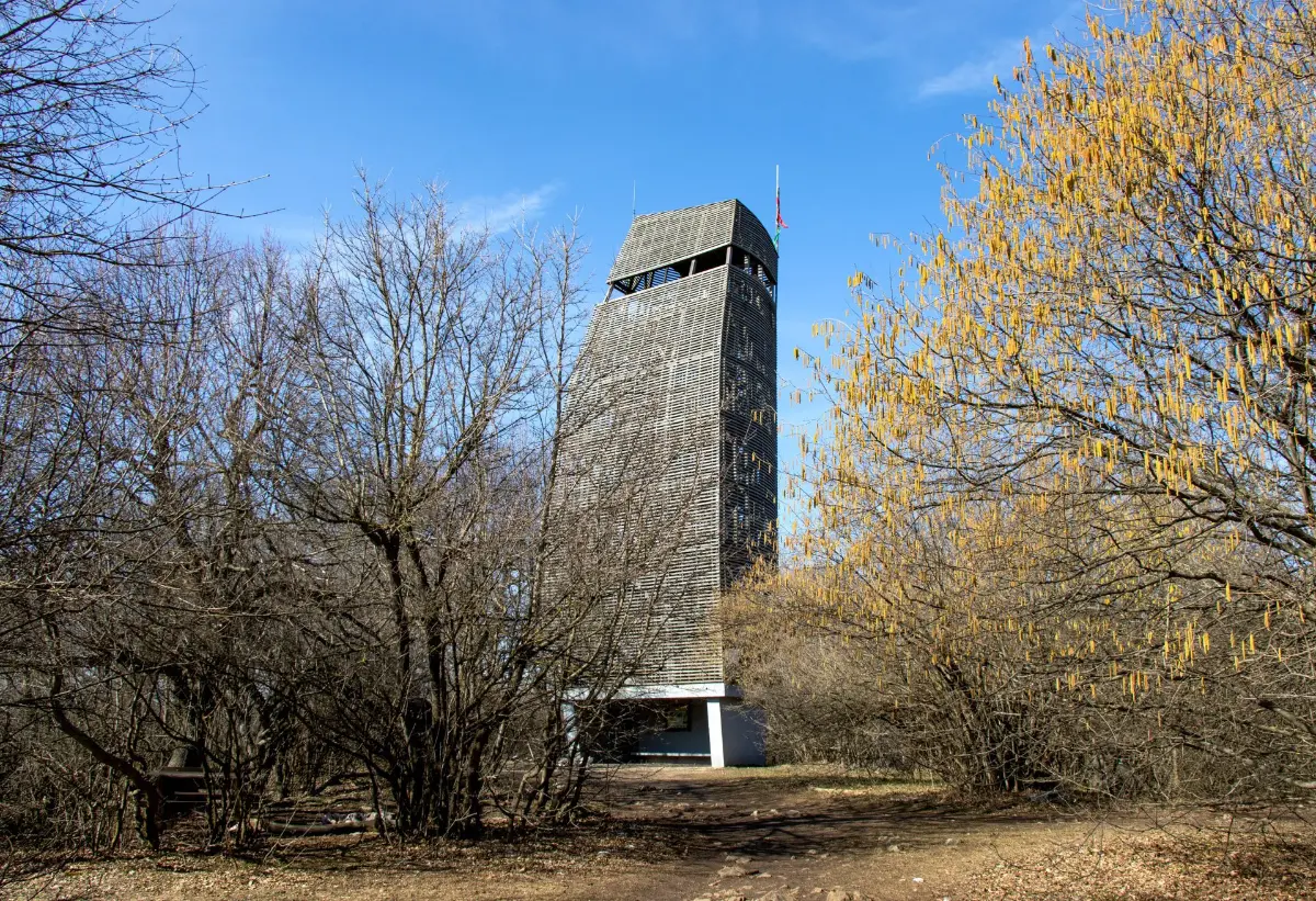
We climb a gravel path to the highest point of the elongated ridge, where a unique, sail-shaped structure breaks up the uniformty of the young forest. An 18-meter-high observation tower appears almost out of nowhere, promising a magnificent panorama at first glance.
The tower standing on top of Nagy-Kopasz was named after painter Pál Csergezán, who is best known for his paintings depicting forest wildlife. The tower, covered with red pine slats, can be reached by climbing 100 steps to the observation deck.
In clear weather, you can scan the landscape for 100 km in a panoramic view, including the peaks of the Buda Hills, the Pilis, the Visegrád Mountains, the Vértes, the Gerecse and the Velence Mountains. Looking north, you can see parts of the Felvidék (the former Upper Hungary) region, and if you are lucky, you can also see the Mátra range to the east.
It is difficult to get enough of the endless views from the huge tower. Only the strong spring wind, which can be quite fierce at this altitude, can prevent you from lingering for too long. Down below, next to the lookout tower, benches and a fire pit provide comfort for picnickers, and here you will also find the stamp of the „From Nagy-Kopasz – to Nagy-Kopasz” hiking movement.
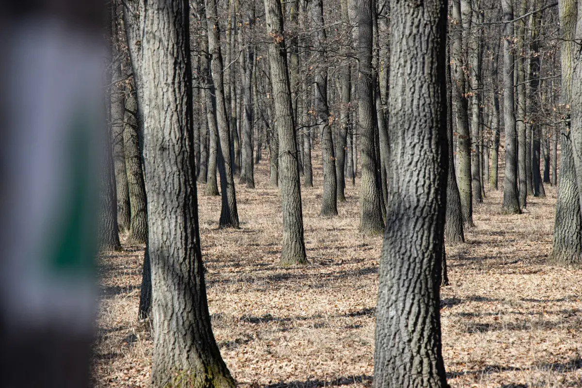
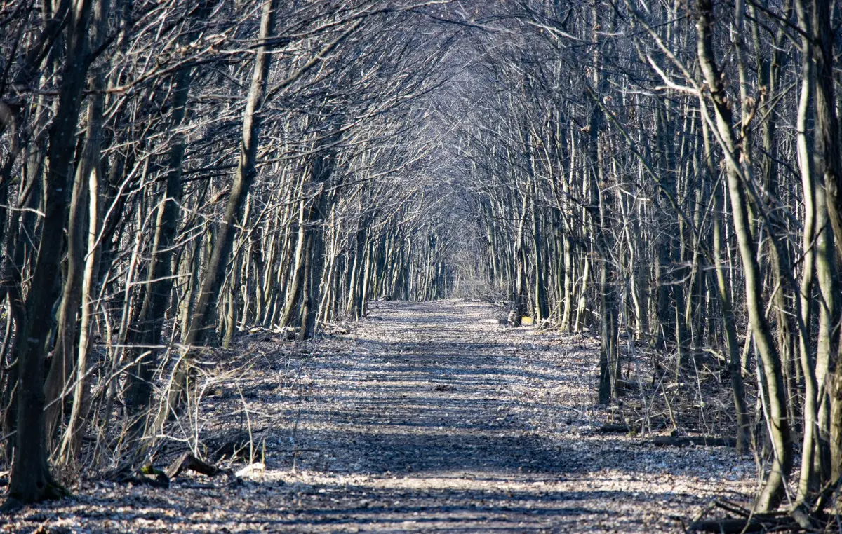
Our journey continues northward. The mixed forest of Cseresznyés also includes gray-trunked beeches, which are species that prefer a cooler climate, clearly indicating that we are now on the northern side of the mountain.
After a comfortable descent, we arrive at the end of the green triangle trail with a long straight stretch: we join the green trail. Turning right onto the dirt road, we follow the sign and soon arrive in Nagykovácsi, but before that we pass the Pásztor-kereszt rest area, where, according to legend, a shepherd lost his life in a sudden storm.
On the southwestern edge of Nagykovácsi, we cross the now dry Ördög-árok canal and walk the last few meters of our hike among houses. The final stop is the bus turnaround at Tisza István Square, which is located next to the Church of the Assumption. If you don’t want to head home right away, there are cafés, pastry shops, and restaurants near the square to round off a sightseeing-rich excursion.
Discover the country with the Hungarian Nature Conservation Association!
If you would like to learn more about Hungary's natural and cultural treasures, visit the Turista Magazine website published by the Hungarian Nature Conservation Association for tips and ideas, or download the Természetjáró app, which offers a selection of the best hiking, cycling, and water tours across the country.
Fotó: Lánzi Péter/ MTSZ