Helyszín címkék:
Six super panoramic viewpoints in the Mátra Mountains
Partner content
Article of the Turista Magazine
What this article is about:
- Galya Peak and one of the most popular lookout towers in the Mátra
- Approaching the Lajos Thuróczy Lookout Tower
- A unique structure in the Mátra region
- Approaching the Kozmáry Lookout Tower
- Nagy-Szár Hill
- The Sas-kő Rock Lookout Tower
- Approaching the Sas-kő lookout tower
- Kékestető TV tower and lookout tower
- Approaching the Kékestető TV tower and lookout tower
- Panoramic lookout tower – Gortva–Jójárt lookout tower
- Approaching the Gortva–Jójárt lookout tower
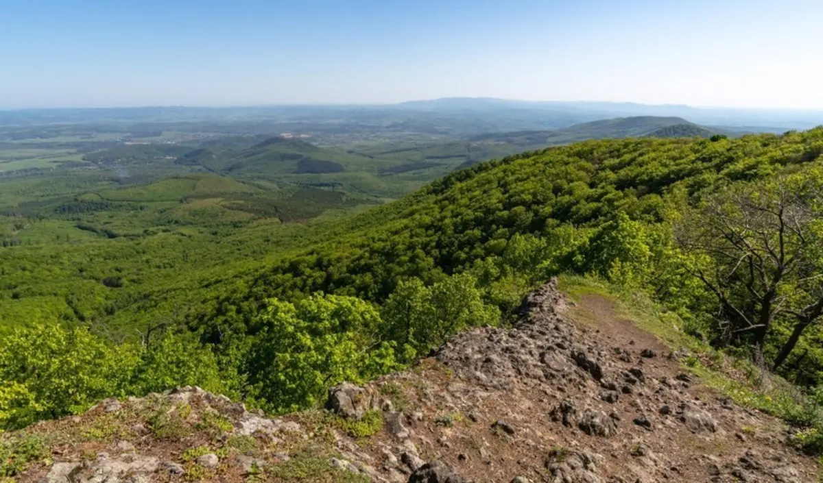
Galya-tető (Galya Peak) and one of the most popular lookout points in the Mátra Mountains
The 964-meter Galya-tető in the Mátra Mountains is Hungary’s third highest mountain peak. Near the summit, at an altitude of 960 meters, stands the geodetic measuring tower built in 1934 on Péter hegyese (lit. Peter’s Hill), which was converted into a lookout tower and bivouac accommodation in 2015.
The top floor of the Thuróczy Lajos-kilátó (Lajos Thuróczy Lookout Tower) (the Galya-kilátó – Galya Lookout Tower) offers one of the most unique panoramic views in the country, which is a result of the location and topography of the Mátra Mountains: the mountain range rises sharply above the surrounding landscape like a narrow ridge.
Péter hegyese in Galya-tető is located at the highest point of the Western Mátra Mountains, but on its edge. Therefore, we can follow the ridge of the Eastern Mátra Mountains, which undulates a little further south, with our eyes all the way to Sirok from the Kékes massif.
Opposite the Great Plain, the landscape undulates gently, with the Bükk Plateau reaching its highest point in the east. In the north, the Heves-Borsod hills and the Karancs-Medves region can be identified, but in exceptionally clear weather, the Low and High Tatras can also be seen in the distance. To the west, the low hills of Cserhát appear, but most of them are already covered by the forest massif of Upper Mátra. In the distance, the peaks of Nyikom and the Muzsla ridge can be seen, but the southern peaks of Mátra can also be recognized.
Getting there
If you arrive in Galyatető by bus, you should get off at the Zoltán Kodály promenade stop. From the Kodály Zoltán promenade bus stop, head toward east, following the signs of P, S, and Mária Road’s ᵯ sign. After walking 400 meters, turn left at the corner of the Galyatető Tourist Center and head up the stairs following the K, P▲, and Mátrabérc ʍ signs. After a 250-meter climb, we reach the lookout tower.
A unique building in the Mátra region – The Kozmáry Lookout Tower
One of the most famous buildings in Mátrafüred, which belongs to Gyöngyös, awaits tourists thirsting for a panoramic view of the North Central Mountains near the 398-meter-high peak of Dobogó Hill, about 370 meters above sea level.
Built in 1900, this stone lookout tower, which resembles a combination of a furnace and a bastion, was named after János Kozmáry, a former merchant from Gyöngyös and director of the Mátrafüred resort. The lookout tower offers spectacular views to the south and southwest, as well as to the northernmost areas of the Central Mátra Mountains: In addition to the town of Gyöngyös, numerous smaller settlements and the TV tower on Hungary’s highest peak can also be clearly seen from here in clear weather.
Getting there
By public transport: Get off the bus at the Mátrafüred bus stop and waiting room, from where the S▲ sign will lead you to the lookout point.
Parking: There are a few parking spaces on Hegyalja Street, at the foot of the stairs leading to the lookout tower, and there are also parking spaces on Béke Street, next to the village center.
One of the highlights of the Mátra Blue Trail – The Nagy-Szár Hill
A steep climb leads up to the 743-meter-high plateau of Nagy-Szár Hill, but it’s worth the effort.
The mountain peak is a clearing, mostly bare, dotted with meadows and shrubs, offering a breathtaking panoramic view.
There is an excellent view of the Mátra mountain range, Kékes, Galya, and to the south, the Markazi water reservoir, but you can also see far into the Great Plain.
The tranquil, peaceful plateau is a great place for a picnic, where you can spend hours admiring the view. The National Blue Trail route passes by the lookout point.
One of the most beautiful rock lookouts in the Eastern Mátra – Sas-kő (‘Eagle Stone’)
One of the most spectacular viewpoints on the eastern ridge of the Mátra Mountains can be admired from the rocky outcrop of Sas-kő. Its uniqueness is due to its location on the Mátra ridge, as within a few meters you can see both the Carpathians and the Great Plain.
The height experience and the view are truly breathtaking.
On the ridge of Sas-kő, at an altitude of 898 meters, the first thing you see is a stone structure: it commemorates tourists who fell during World War I and was unveiled in June 1930, on the day the Kékesalja mountain hut was handed over. Leaving the parapet behind, we can walk out to the edge of the rock face, where the height and the view are truly breathtaking.
The entire northern panorama unfolds from the narrow rocky ridge: behind the villages clinging to the foot of the Mátra, rolling hills undulate, and we can recognize the Karancs massif, the Medves plateau, the heights of the Heves-Borsod hills, and to the east, behind the Mátra ridge, the extensive plateau of the Bükk outlines the horizon. In clear weather, the Aggtelek Karst can also be seen in the blue distance, and with a little luck, you can even see a significant part of Slovakia.
Getting there
The Kékestető, Sanatorium bus stop is closest to the rock, but if you arrive by car, there are several paid parking lots in Kékestető.
From Kékestető, follow the K and S signs together to reach the peak of Sas-kő (1.9 km).
From Markaz, follow the Z sign to reach the saddle called Markazi-kapu (Markazi Gate), from where you should continue straight on the K sign (7.8 km).
From Parádfürdő, follow the Z sign eastwards to reach the ridge, where you turn right at the K sign to reach Sas-kő (9.1 km).
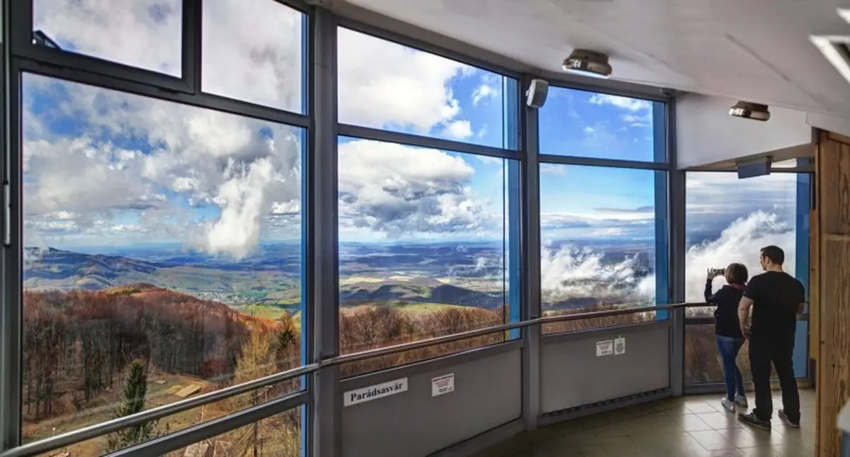
The top of the country – Kékestető TV tower and lookout tower
Our selection of Mátra attractions would not be complete without the distinctive TV tower standing at 1,014 meters on Kékes, the highest point in Hungary, which features a covered and open observation deck and a snack bar. From the observation deck, approximately 42 meters high, you can enjoy a uniquely beautiful panoramic view. In addition to every significant peak in the Mátra Mountains, on a clear day, you can see the Tatra Mountains to the north.
Getting there
By public transport: If you are traveling by bus from Budapest or Gyöngyös, it is best to get off at the Kékestető, Mátrai gyógyintézet (Mátra medical institute) stop.
From the bus stop, walk westward along the P and Z signs, which turn left into the forest in front of the sanatorium building. After 200 meters, turn right at the National Blue Trail K sign, which will guide you to the lookout tower (400 meters in total).
If you are arriving by car, turn off Route 24 at Mátraháza toward Kékestető, as indicated by the sign. The parking lot right next to the tower is paid parking.
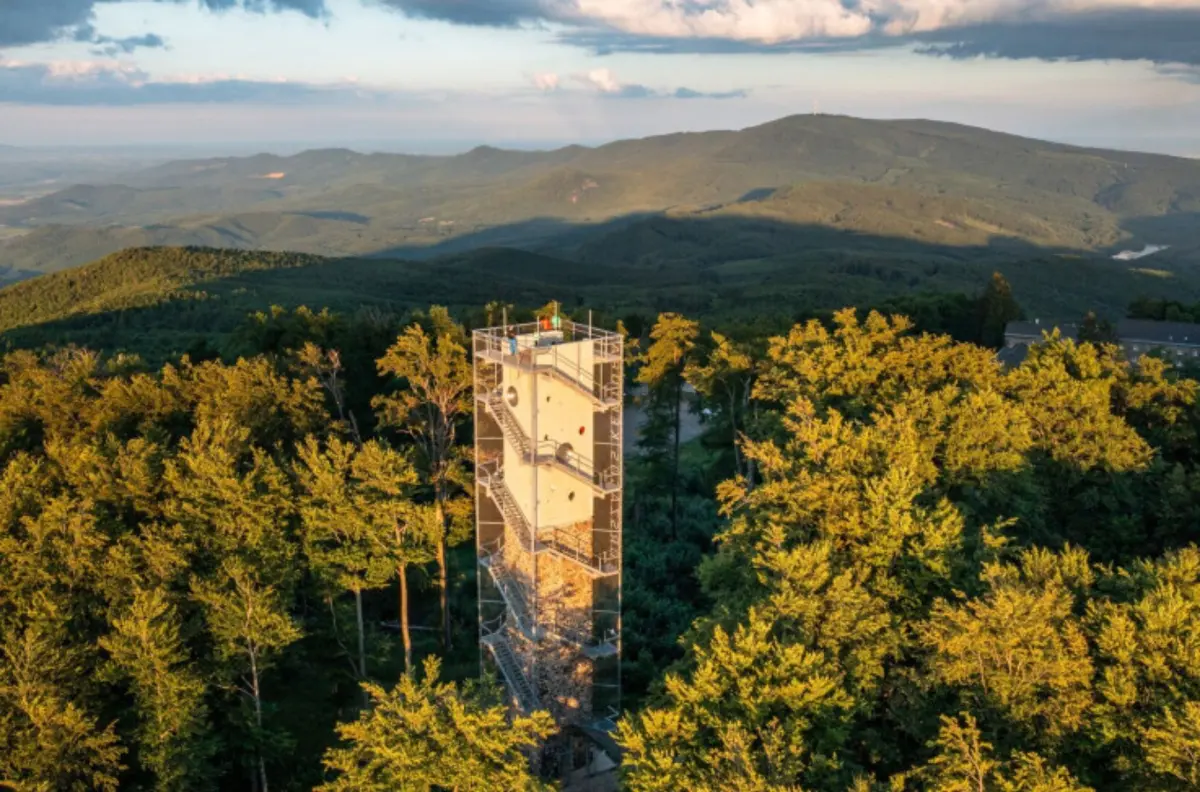
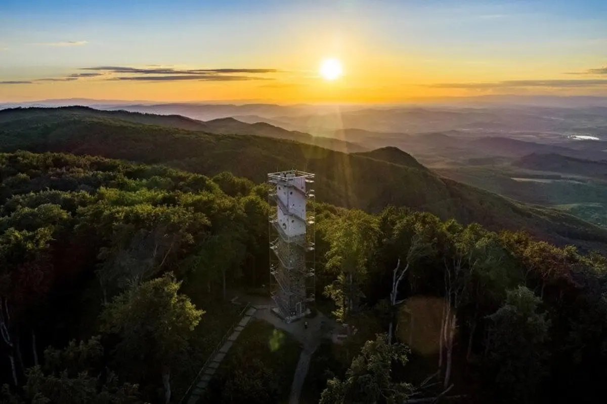
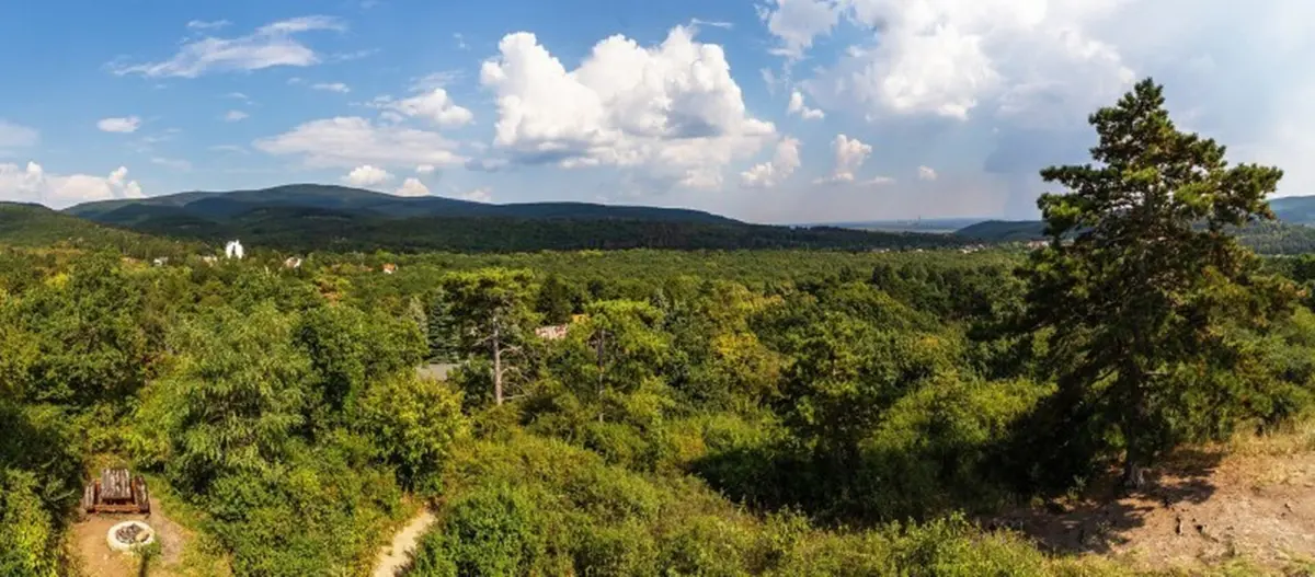
Panoramic lookout tower and shelter in one – The Gortva–Jójárt lookout tower
There is a unique andesite tower at the top of Nyikom. The forest surrounding the lookout tower is privately owned: it belongs to Zsolt Gortva, who dreamed up this multifunctional building on the highest point of his estate and gave it to his wife, Borbála Jójárt, as a gift. The whole thing was created entirely from their own resources, using private capital.
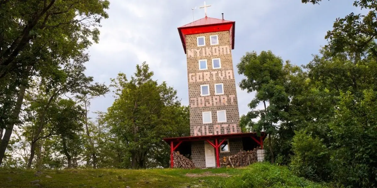
What makes it multifunctional?
The tower serves as a free shelter for the night.
There are a total of five levels to choose from, and on several of these levels you will find sofas, couches, and furniture suitable for sleeping. A stove at the bottom helps to keep the place warm on winter nights, while a chimney pipe inside is responsible for heating the entire building. Benches and tables were placed on the top floor. There is a toilet at the back, and during the summer semester rainwater is collected in barrels, providing an opportunity for washing.
The panorama is also unforgettable: beyond the windows, we can see the entire Mátra mountain range. The Muzsla ridge is located southwest of the main massif of the mountain range, with its northern peak being the 764 m high Nyikom. Therefore, we can see side by side the flat-topped ridges of the Mátra Mountains, which “have no peaks”, and the highest points in the country: Kékes-tető (Kékes Peak) (1014 m) can be identified by its transmission tower, and Galya Peak (964 m) by its buildings.
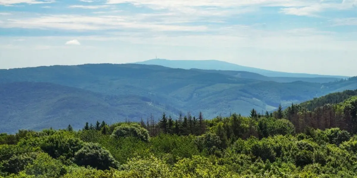
Further south, the more distinctive peaks of the Mátra rise up: for example, the regular pyramid of Havas, and in the other direction, in the neighboring area, Ágasvár. There is a beautiful view of the Zagyva Valley and the Tepke Ridge on the other side, as well as the entire Cserhát Mountains. The double-peaked Szanda is also easily recognizable. In clear weather, we can scan an astonishingly large area: it is difficult to identify specific points on the Great Plain, but the Börzsöny Mountains – which culminate in Csóványos –, the Visegrád Mountains, and the Buda Hills are easily distinguishable. In the north, the Karancs mountain range stands out, but sometimes you can also see the chain of Low Tatras. Labeled photos placed next to the windows help visitors identify the most important points of interest in the surrounding mountains and hills.
Getting there
The lookout tower is also accessible from Pásztó and Mátrakeresztes. From the bus stop in Pásztó, follow the P sign towards the town! From the train station, take the tourist trail marked ‘Z’ to Fő utca (Main Street), then turn right onto the Z trail. This sign leads to the Nyikom saddle, where other roads also join. A sign here indicates that we can find the lookout tower by turning left and walking uphill on an unmarked path (approx. 10-15 minutes on foot) (7.8 km).
In Mátrakeresztes, look for the signs in the restaurant courtyard, on the right side of the wooden bridge! We have to start our journey at the P sign, then switch to the P lane to reach the Nyikom saddle. Here, we will need to take the unmarked path behind the signpost for the lookout tower to find the building (4 km).
Discover the country with the Hungarian Nature Conservation Association!
If you would like to learn more about Hungary's natural and cultural treasures, visit the Turista Magazin website published by the Hungarian Nature Conservation Association for tips and ideas, or download the Természetjáró app, which offers a selection of the best hiking, cycling, and water tours across the country.
Photos: Hungarian Nature Conservation Association (Turista Magazine) / Péter Farkas (cover photo, photo 1)
Photos: Hungarian Nature Conservation Association (Turista Magazine) / Attila Gulyás (photos 2-3, 5)
Photos: Hungarian Nature Conservation Association (Turista Magazine) / Áron Dömsödi (photos 4, 6-7)