Helyszín címkék:
Autumn-winter panoramas from the Witness Mountains – Where are the best places to go hiking in the Balaton Uplands at this time of year?
Kilár Boróka
What the article is about:
- Badacsony – a panoramic view from the Kisfaludy Lookout
- St. George’s Hill – Basalt organ pipes and the dragon legend
- Csobánc – castle ruins and panoramic views
- Haláp – the mined-out mountain
- Tóti Mountain – Panoramic views of the Tapolca Basin
1. Badacsony – Panoramic view from the Kisfaludy Lookout
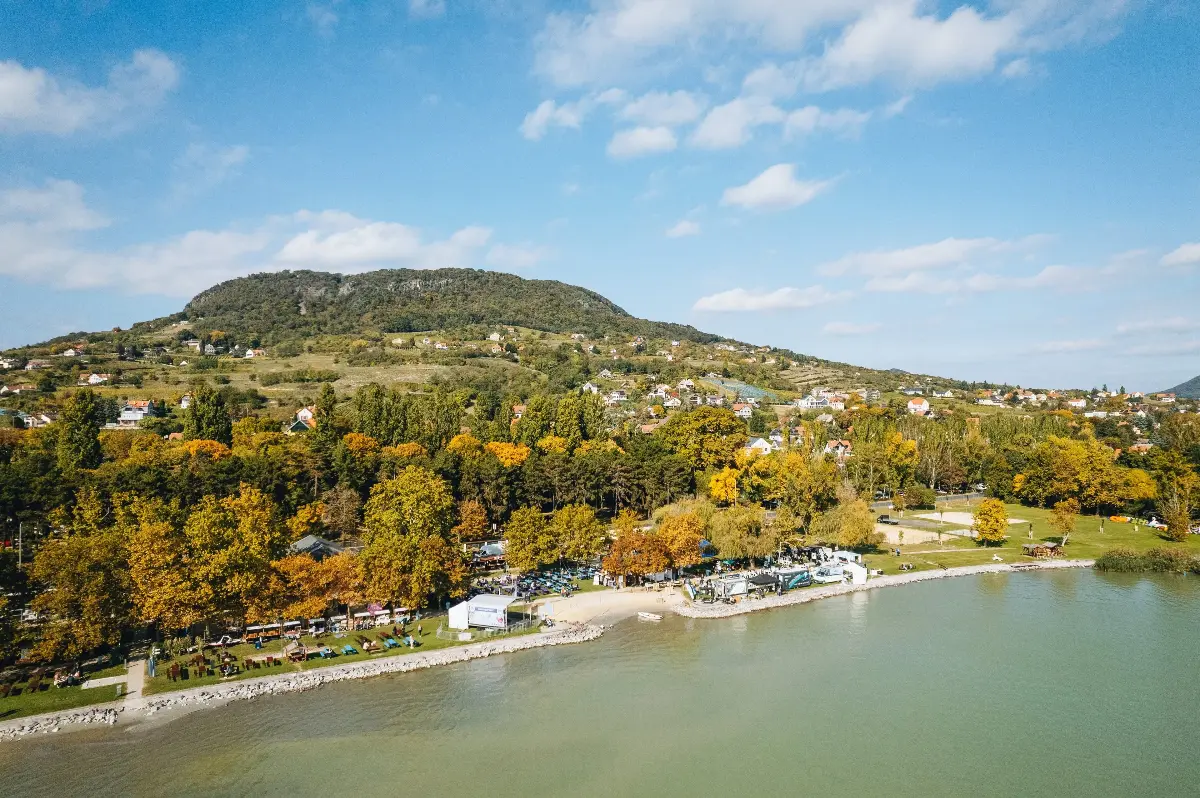
In Badacsony, you’ll find several interesting stops even on the road leading up to the summit. It’s worth starting near the Badacsony boat station, then, as you head uphill, you can pop into one or two cosy wine bars. The Laposa Wine Terrace, for example, is open all year round. If you persevere, you’ll soon reach the famous Rózsakő, which is linked to a romantic legend. According to it, if a girl and a boy sit on this huge basalt rock, holding hands and with their backs to Lake Balaton, they will get married that very year.
From Rózsakő, following the red signposts, we can head towards the Bujdosók lépcsője (‘The Stairway of Fugitives’). The flight of steps winding between the basalt columns consists of 465 steps, therefore the climb requires a fair bit of stamina. If you’d rather focus on the views, follow the blue triangular signs towards the Kisfaludy Lookout! From the top, you can admire the characteristic hilltops of the Tapolca Basin.
It’s also worth visiting the Ranolder Cross, which stands near the summit: on a clear day, you can see as far as Szigliget Bay and the southern shore. Depending on the route you choose and any detours you take, you should allow at least 2.5–3 hours for the walk.
2. St. George’s Hill – Basalt organ pipes and the dragon legend
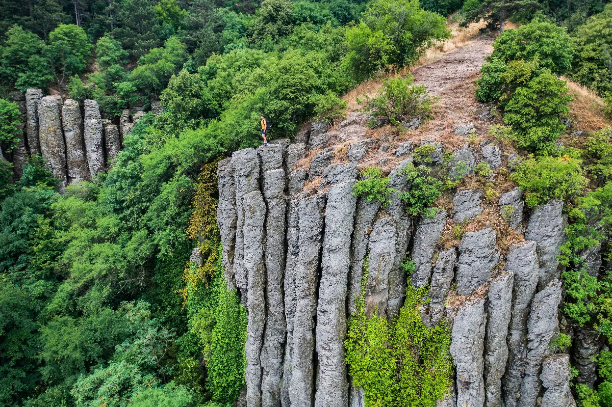
One of the most remarkable sights on St. George’s Hill is the row of huge basalt columns rising from the hillside. On the walk starting from Kisapáti, you can also reach these geological formations. The path winding its way between the column-like rock formations, several metres high, is very picturesque.
If you’re arriving by car, you can set off from the car park next to the Kisapáti cemetery. From here, follow the green tourist signs to reach the Károly Kaán mountain hut, then continue the ascent along the blue trail towards the basalt columns and the summit. On a clear day, from the summit you can see as far as Badacsony, Gulács and Tóti Hill. The round-trip route to the summit is roughly 7 kilometres, thus it’s worth setting off at a comfortable pace, wearing suitable walking boots.
We can also choose the ‘Basalt Organs’ Nature Trail, marked with a red ‘T’, which starts from the former basalt quarry near Raposka. This circular walk of nearly 4 kilometres leads up to the peak via seven stops, and along the way we can read information boards highlighting geological features and the local wildlife.
3. Csobánc – Castle ruins and panoramic views

One of the most popular vantage points in the Tapolca Basin is the castle ruins atop Csobánc. From the mountain’s summit, you can see the landmark hills of the Tapolca Basin, including Badacsony, Gulács and Tóti Hill. It is no coincidence that this summit has also become a favourite spot for paragliders.
From the direction of Gyulakeszi, you can make your way up through the vineyards and along the hillside paths to the plateau, where you can also see the remains of the Medieval fortress. The castle’s history is linked to the Gyulaffy family. László Gyulaffy, the castle captain, became renowned in the 16th century for his battles against the Turks. In 1566, he took part in the recapture of Veszprém and was also regarded as a famous jouster. The Turks laid siege to Csobánc Castle on several occasions but were unable to conquer it.
The hike, which starts from the Gyulakeszi castle car park and is approximately 4–5 kilometres long, involves an elevation gain of around 250 metres, and it is worth allowing roughly 2–3 hours for it. If you do not wish to return via the same route, after the castle, you can descend along the blue trail, then turn off towards Mária-út at the Vár-kúti junction to complete a loop around the southern side of the mountain. Be prepared for a moderately difficult hike, and watch out for the stony, uneven ground around the castle ruins! There are no snack bars or restaurants on the mountain, therefore be sure to bring water and a snack with you!
4. Haláp – The mined-out mountain
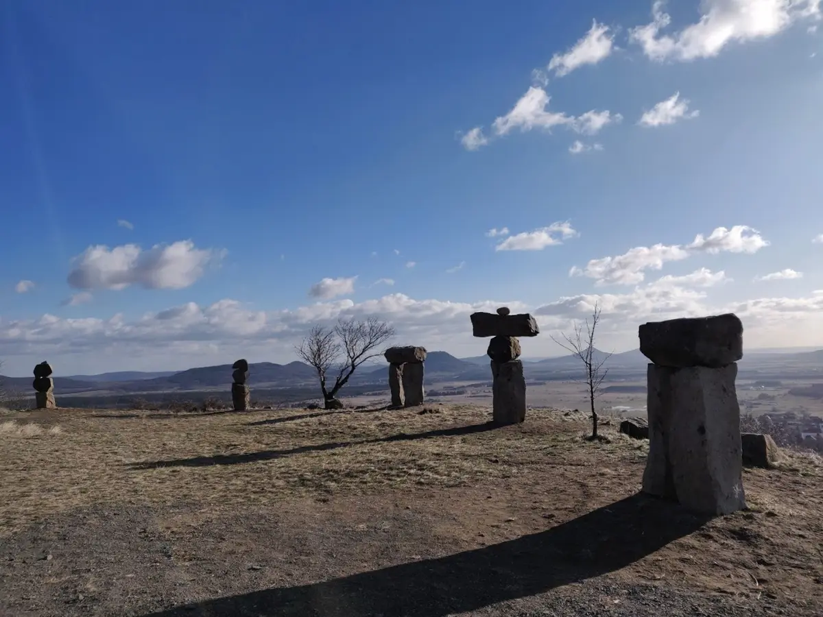
Haláp Mountain is an unusual hiking destination: the landscape of this once flat-topped witness mountain has been thoroughly reshaped by decades of basalt mining. A significant portion of the summit has been quarried away, thus today, in the former mining yard, you can hike amongst huge basalt walls and columnar rock formations.
By walking the ten stations of the nearly 3-kilometre Haláp Nature Trail, you can learn about the mountain’s geological features, its mining history and the local wildlife. Along the way, it’s worth taking a look at the basalt sculptures in the Ébredő Vulkán (‘Awakening Volcano’) sculpture park. From the edge of the mountain, there are views over the Tapolca Basin, Csobánc, Badacsony and the surrounding witness mountains.
Allow approximately 1.5–2 hours to walk the nature trail! You can set off from the car park on the Zalahaláp side; sturdy walking boots are recommended on the stony, occasionally steep paths, and take particular care on slippery ground in wet or icy weather!
5. Tóti Mountain – Panoramic views of the Tapolca Basin
Tóti Mountain is one of the smaller isolated witness mountains of the Balaton Uplands, with a height of 346 metres. From the summit, however, you can enjoy a sweeping panoramic view. Setting off from Káptalantóti, you can make your way up the mountain through vineyards and wooded areas, before reaching the summit after some steeper sections. From here, the surrounding witness mountains, the Tapolca Basin and, on a clear day, Lake Balaton itself come into view.
During the walk, thanks to the information boards placed around the mountain, we can learn many interesting facts about the area’s geological and natural features. Depending on the starting point, the round-trip is approximately 4 kilometres long, with an elevation gain of around 200 metres.